Friday, April 30, 2010

Hart Route Freesolo Pt. 1 -- Recon


Six-and-a-half hours of pure, kickass adventure in Camelback last weekend. I freesoloed Hart Route -- something I've been thinking about doing since the first time I climbed it back in 1989. (Click on picture for close-up, with dotted route-line). I went on a recon mission to the place a few weeks ago, climbing up the first pitch after being invited to climb through by some folks who'd gotten up earlier than me. The pitch is rated 5.0 in some guide books, but it's really a 5.2 by today's standards. It's hard to know what to compare Hart Route to -- there are relatively few climbs out there rated 5.0 to 5.4, and they're usually underrated instead of overrated. Unlike a gym climb, it's not sustained, and it's not always vertical. But each of the three pitches on Hart Route has moves that would be rated 5.2-5.7 in the gym. Add in the diceyness of Camelback rock and the quality exposure of each pitch, up to the top-out at 150 feet or so, and this climb becomes something quite unlike any gym or shorty sport climb. It gives me the same feeling I get while on trad lead, or even trad seconding -- an hours-long rush of adrenaline, fear, happiness, mental control and physical satisfaction. Freesoloing anything allows me to reclaim my human-animal roots, the need for excitement missing in daily modern life. And Hart Route is a good freesolo for me -- not too hard, nothing to keep me up at night when I'm done. It's extreme, by the average Camelback hiker's standard, but not too extreme for people who feel comfortable running out a lead in the 5.6-5.8 range, which includes me.


Spending time like this at Camelback is a fantastic mountain escape.


But I digress.
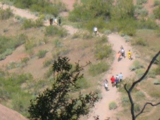


The first pitch of Hart Route is quite easy, to the big hole 3/4s of the way up. After that, footholds on the left become trickier at the same time the handholds get thinner. On the recon day, at that section, I angled left to a spot with bushes and a moderate overhang. Climbing in full static mode, as I do sometimes when I freesolo so that I can reverse the moves without much thought, I pulled myself into the final moves after a bit of leg shake. I'd initially felt like a total badass after the guy in the picture told me to come up -- another guy and a woman were waiting to top rope and I figured my unroped ascent looked kind of impressive. Then I ran into that muck at the top and looked like a wanker. Truth be told, I only topped out on that shite because, in the back of my head, I figured I would ask the guy for a lower-down so I didn't have to down-climb that last part with my ass 50 feet above the deck. I hate down-climbing overhangs on freesolo and try to avoid climbing up them in the first place, ever since my hardest all-unroped climb -- my freesolo of Rappel Gully (5.4) back in the 90s. That one has a nasty little overhang right at the top, about 70 feet up. It wouldn't have been a big deal -- except I'm too familiar with Camelback to think I can safely trust my life to any one hold. When I talk about climbs that keep me up at night, that's one of them. On Hart Route, had the bloke with the belay not been there, I'm sure I could have downclimbed the upper part of the first pitch, but it would have been scary.


I snapped this picture of the guy, then asked him if he'd lower me. It turned out that a purple biner I'd found at the base of the headwall was his, and I gave it back to him when he asked if I'd seen it, so you could say he owed me one. (I never would have used it, anyway. You don't know where found biners have been -- if found at the base of a crag, like this one, I assume it probably fell and might be damaged, even if I can't see any evidence of a crack, scratch or dent). I forgot to mention that for the recon mission, I only had my rock shoes and chalk -- no rope or harness. The guy asked me how I wanted to do the lower. I tied a figure eight on a bight in his rope, clipped a biner on it for a handhold, then asked him to lower me down to the easy part at the big hole, which he did.

In spite of the assisted downclimb, the whole experience got me thinking seriously about freesoloing the whole thing. I'd been playing around with the notion in my head in the days before the recon mission. Of course, I'd have to bring a rope with me in case I needed to bail, and for the convenient rappel down Pedrick's Chimney when I was done. Now I knew the top of the first pitch was sketchier than I really wanted, but having climbed it without a rope made me confident I could do so again. I stuck around awhile, trying to learn something from the blokes belaying up Hart Route, but they took so long to move I had to bail off the headwall area before they reached the top of the second pitch. That meant I'd be doing the freesolo without beta on the second biggest objective danger (the first being gravity) for any climbers on Hart Route: the deadly beehive. I only wish the adjective was an exaggeration. A few years ago, a guy named Keith Abbe  died on Hart Route after he and his partner were attacked by the bees that live on top of the second pitch. Abbe didn't die from the stings, though he was stung about 100 times, if memory serves. He died because he and his partner were not skilled enough to set up an emergency rappel while under the insect bombardment. I have no idea whether I am, for that matter, and I hope I never need to find out. The partner, whom I interviewed for an article in the East Valley Tribune about the tragedy, told me that he made a command decision as the leader of their expedition that they should untie the knots from their harnesses and downclimb as fast as possible. Abbe apparently didn't get very far before he slipped and fell at least 50 feet to his death.

Three weeks after freesoloing p1, I found myself at the base of Hart Route again, ready to push as high as I felt safe in doing.

Click here for Part Two: The Ascent

Saturday, February 7, 2009

Photos With the Canon A630


This is a low light shot from the A630, the camera that replaced my first digital camera, the venerable 3.2 megapixel Canon Sureshot ELF. I liked that camera a lot, but the A630 has many more features and is 8 megapixels. I've found that it's easier to take a lower-light close-up in focus with the smaller camera, useful for "copying" documents. I've learned to use the flower icon for close-ups now, though, and that seems to make things work better. The one thing that drives me crazy is that when it's on manual, you can set the focus in the little viewfinder box that pops up on the screen so that whatever you're trying to capture looks crystal clear. And then when you press the shutter button it goes out of focus. I have no idea how to stop that.


Shooting long exposures is fun for making "ghost pictures" with the kids, but until I got a tripod for the camera the feature was almost useless. I've got a beefy tripod I use with my camcorder, but never carry it around because of its size. A few weeks ago I found this wonderful little tripod, about eight inches high, with three bendable legs that wrap around most anything. Since then I've been able to try more pictures like the twilight shot above, taken on the trail with a 1/3 second exposure time and 4.1 f-stop. While this kind of thing is nothing for a professional, the level of detail is much better than it gets on the automatic setting. It's good practice, too, in case I ever find myself with lots of time and amazing scenery to shoot.


The longest exposure setting is 15 seconds, but with that I took a couple of relatively decent pictures of stars in the back yard. What's really amazing is that these pictures were taken in Tempe, where there's so much light pollution it's hard to see more than a couple-hundred stars on the best nights.

This is how the A630 sees the Pleaides:


In the next picture, the nebula in the sword of Orion is clearly visible:


And here's the full shot of Orion (from which the above was cropped):


Saturday, September 20, 2008

George Route -- Half of It, Anyway

Karabin's guide calls this an adventure route -- he's right about that. In Phoenix Rock, the route shows as linking up with the v-notch above the rescued dudes perch, the west-facing notch from which I emerged on the last August Canyon trip. I only got halfway. It's easier than the Neck route -- goes up straightforward terrain to the little green bush near the bottom of this picture, just left of center, then heads right in sort of a ramp-shelf system. I explored that frozen wave-looking thing, bit of a drop on the other side. Kept pushing right till the climbing got way intense for having no protection. Actually, I stopped right before it looked like it was going to get way intense -- around a corner on easy, but thin ground. If it was five feet up, anyone would try it. It's 300-400 feet off the deck right there. One slip and it's the express route the whole way down, barely a bounce before the big plunge. Extreme exposure. There are enough bolts on this route to minimize that danger -- I figured I'd come back sometime with a rope and maybe a partner and try it. But first I wanted to go as far as I could, so I pushed onward, already starting to feel the beginnings of that exposure. That's when the sentinel buzzed up to me, the lone sentry ordered to spy on this ridiculous wingless mammal clinging to the rock -- and to deter said mammal from going any further. The bee darted all around me, but not like the horse flies that zoom at 300 mph in figure 8s around my head sometimes at Camelback -- the bee flew purposely slow, as if to better use its eyes. Its buzz was like a red alert in my head -- I'd seen this behavior before. Bees are really smart and don't want to mess with people, any more than they want people messing with them. When a hive is nearby and menace lurks, advance guard bees will steer people away from them. And that's just what I felt this bee was doing. Which meant, of course there was a hive nearby. Except I doubted all the non-scientific gobbledegook I just spoke of -- I'm no bee scientist, and I don't really know how bees act. How could I know whether there was a hive or not? So I decided to keep heading around the ever-steeper mound of the corner of red rock, trying to peer at the terrain beyond, seeing what I might be up against if I made it around the corner without slipping, deciding there were a few very hairball parts on the other side of the corner, then heard and saw more bees. I stopped, focusing on the air just over the bulge of rock. Yes, there were bees, but were they just working a flower patch on the cliffside for some nectar? No. The little bee bodies I saw zipping to and fro just ahead were clearly converging on a central point around the corner on the northwest-facing cliff. It was a hive, all right. I aborted the whole plan right there. It seemed foolhardy, to say the least, to risk disturbing that hive while on sketchy, steep Camelback rock above a 300-foot-plus death fall.

The next two shots were from the bottom -- the exit of George route is marked "top" on each. In the first picture, note the horizontal crack-line at the left -- that's where the beehive is. The corner I'm talking about, and my stopping point, is the ground immediately left of the long horizontal crack. If it weren't for the beehive, it's possible to suck it up and traverse the corner, drop down onto a large ledge where those bushes and palos are growing just right of the crack, then scramble upward to the top. Definitely more trippy than pumpy. A fun adventure, which is exactly what I'm looking for.


Saturday, August 16, 2008

Mission: Failed (But Not Really)


Definitely a day to remember. Skyed it to August Canyon on a Tuesday afternoon, no one around, temperature soaring well over 100. Actually, there were quite a few cars in the parking lot considering the temp, maybe 10 or so.


I felt very privileged to be going on such a decadent adventure, and able to write it off as work. As always on such scorching days, the others at the mountain were the hard-people, the ripped dudes and dudettes who bound up and down Camelback like ibexes. I had my big gray approach pack:


Inside was an orange, two big Nalgenes of ice water, my 160' rope, harness and assorted gear, sunblock, knife, phone and climbing shoes. Notice I didn't say chalk bag. I left that in the Jeep. Realized that sad fact just as I got up to the top of the second handrail section, too far to go back. Who needs chalk. Just a crutch, really. Even on a hot day like this, possibly the only kind of day when chalk might be necessary, I talked myself into believing it wouldn't matter. Thankfully, it didn't. But it could have on a different day, on a different route.


As the firefighters had said, once I turned right at the top of the handrail parts (not the first steep part, but the second one), I found the class 4 back door to August Canyon. I passed this route at first, believing it might be the 5.7, Line of Fire. The trail keeps going from here so I followed it until it dawned on me that, no, as much as I didn't want to believe it, this was the class 4. Karabin's Camelback pamphlet calls it a 5.2. This is the spot the rescue victims climbed, according to a fire captain I talked to. Though the firefighters call this a class 4, I'd say it's at least a 5.0 or 5.1. Some moves are comparable to a 5.5 in the gym.


I had walked up to this thing and taken a closer look on the first pass, so I knew the beginning was doable. But it had the look of a serpent's mouth to me - it was balls-to-the-wall free solo and I'd wanted no part of it.

A few minutes later I found myself at its base again. I put on my climbing shoes and danced up the first 40 feet just to see how things were going to go, ever mindful of how I would down-climb. I decided to practice that start twice because I knew I'd be coming down with less energy, and I wanted to try it with the pack.


Here's a picture that ran with the blog post I wrote for NT.


This was a mini-epic for a few different reasons. One is that I was alone, and the southeast side of the Head was deserted, which it probably would have been even if it wasn't about 107. The heat meant few people were hiking the Echo Canyon trail -- put it all together and that means if I fall, odds are slim anyone would know for a while, especially if I was unconscious and couldn't yell for help. In that case, I'd be totally screwed. This is one of the realities of solo adventure, but the risk, paradoxically is also one of the joys. Taking on heavy responsibilities and meeting challenges, in this setting, is somehow like stealing jewels from the dragon's lair.


The climbing was easy, but only just so. The footholds were solid and positive, but thin, so that my heels stuck out on much of it. I saw at least three bolts on this section. After the first 20 or 30 feet the angle mellowed out and more good holds appeared. The rock quality, however, took a turn for the crappy. (No more bolts, either.)

A solid route exists there, but I had to pick my way carefully 'cause this was no place for a rush job. I wasn't gripped on the ascent. Highly focused, yes. I was happy to make that right-hand turn at the top there and ease on up to the August Canyon plateau.


This is a shot of my hiking shoes and a water bottle that I left at the bottom. There's a big eyebolt up here, but I think rapping it would take a double rope. My guess is this about 100 feet up; the eyebolt might be a bit more.


This was from a little further up. It was fun scrambling, pretty much, from the top of the 5.1 to this point.


I found this cozy little nook and thought it might be the access point to the north face. After I hopped up on the bulgy part in the middle, though, I heard a loud buzzing sound -- bees. My catlike reflexes went into action -- or so it seemed in retrospect. I'm sure it didn't look pretty, but I jumped off the rock with a bit of a spin, landing in that sandy part there and running back out nearly in panic. My only thought was to put as much distance as possible between me and the hive before they targeted me. I knew a swarm attack here could be deadly -- probably the biggest objective danger at Camelback. You could be as cautious as a mouse and a world-class climber to boot and still end up dead with the venom of 500 stings in you. Or maybe you only get one or two hundred stings before you do something crazy and slip off a cliff face. I tiptoed back in here after I realized they weren't coming after me. Sure enough, there was a hive in there. Look at the formation on the left -- see how it looks like a whale lying on its right side, with the big crack becoming the dark line of its mouth and the pocket above it the whale's small, black, set-back eye? The hive is the eye. Dozens of bees were flying in and out of it every second, and I tried not to breathe too heavily, thinking they might not like that. I wondered -- if they attacked, which would be the best course of action: Try a single-line rappel or down-climb the 5.1. Having a rope to descend would be safer, of course, except the bees would annihilate you during the set-up. You'd have to do it blind, with your shirt pulled above your face, else you'd need your hands to scoop the bees out of your eyes. A quick figure eight on a bight, quick biner clip, then either batman (possibly tearing all the skin off your hands) or rappel, but the rappel takes another minute to hook up and the bees are all over your arms, your chest, your neck. The rope would be tangled -- of course it would. A bad tangle would mean death. Then there's Option B -- climbing. As mentioned, the bees go for the eyes and mouth -- it might not be possible to downclimb and keep the bees from the eyes at the same time. Blindness could occur rather quickly as the eyes swelled up. But route-finding on the 5.1 is essential. Going more than a few feet off route could mean disaster. You'd quickly downclimb to a blind alley, then have to climb back up and try another path, assuming instinct didn't keep you downclimbing until a slip occurred. The guy I interviewed for the Trib managed to downclimb Hart Route while being stung by wave after wave of bees, but I know Hart Route fairly well and it's hard to get off route there. It's very straight-forward. Not like this 5.1, which requires extra focusing of the eyes just to see the route under ideal conditions. Whether Option A or B would be chosen would probably depend on the severity of the attack. A heavier attack might prompt a decision to downclimb, though in fact the downclimb might only be possible under a lighter bombardment, which would mean the right decision would be counter-intuitive and thus less likely to be chosen in an emergency.


Here's evidence of some of the "gardening" the firefighters did. This was after I found the notch that led to the north face. There's a wonderful little cubby spot here with a sublime view. There's also a fair sprinkling of garbage up here, lots of empty water bottles which I assume are also from the rescue.


The view from this notch is fantastic, and strikingly different than what 99 percent of hikers will ever see at Camelback -- as are many of the views from the various climbing routes. This scene looks north past a section of the Echo Canyon trail. That's the main bouldering boulder in the middle of the trail slight left of center.


A view of some of the upper bluffs.


Here's another reference from where this was. Above is a shot is from the parking lot...


And this is a shot of the parking lot from that spot. I still find it hard to believe it's 400 feet to the ground from this perch. More like 250 or 300 max, I'd say.


Anyway, I consider the mission a failure because I never made it to the rescued dudes' perch. I descended about 40 or 50 feet from the notch opening, down a fairly clean dry water fall -- not totally dry, though -- there were at least three pools of water ranging from about one to two feet in diameter, each with a dozen or so bees taking a sip. I gingerly picked my way around those and stopped about 40 feet above the perch. I would go no farther, making this trip a failure.


The downclimbing from that point became sketchier, in the neighborhood of the upper part of the 5.1. It looked potentially doable, but it was about 6:30 or so by then. I decided to abort the mission since it was going to take some time to climb back up to the notch, trek across August Canyon to the downclimb, then do the downclimb (the prospect of which had left a seed of anxiety growing in my stomach from the second I reached the top of it).


This is such a great area -- I'd love to go back soon. Exploring around the Canyon would be fun, and I'd like to find the four-chain rappel for Suicide and Suicide Direct, which should be accessible a bit further west in the canyon. The growth gets kind of thick in places and the potential for bees or rattlesnakes are the only bad things about this place. It's about as good as it gets for a desert hideaway.


Sunday, August 10, 2008

Initial Recon

Here's the rescue site outlined in yellow. Had a good chat with the firefighters today - it's sure tough to try to second-guess them. I will withhold judgment either way until I do the class 4 up the back side and climb to this spot. It looks a little hairy to me in terms of exposure. The climbing might be easy, but one slip and it's a 400' death fall. Even from the bottom there appear to be decent pro opportunities, though that's another thing that can only be verified from the actual spot. Unfortunately, I ran out of time to explore the area after my interviews. And to some extent I misjudged just how long it would take to get to the site, since until today I didn't know where it was. One surprise was the height of the site from the ground. These guys estimate 400-450'. And it's obvious there are no good ledges with pro placements on that wall directly below the site (which is mostly blocked by rocks in the foreground, in this picture). Rappelling with my 160' rope not an option. But it would hardly be necessary -- the only logical place from that roost is back up and over, onto the back side of those bluffs, and the firefighters say that is class 4. I may consider fixing my rope back behind that "v" notch to the right of my yellow circle. It sure is a long way down. Here's a picture of the firefighters I never used for the NT blog:

Thursday, August 7, 2008

Sunday Appointment

Talked to a captain from Phoenix Fire -- we're going to Camelback on Sunday so he can show me the site of the rescue. I'm now convinced this will make a good blog for work. Still not sure what terrain is like near the cubby where the "victims" holed up as they waited for help. It looked easy on the video, but there's a 300' cliff right below, supposedly. The captain tells me these guys ascended the headwall from a 140' class 4 section located on a southern exposure accessible from the summit trail by taking a right at the top of the steepest handrail section. I think that's where the 5.7 "Line of Fire" route is, something I've always wanted to climb. The dudes hiked all over August Canyon while looking for an easier way down and eventually found the cubby. That's the point where they called 911, I guess. Captain says the weaker climber was scared out of his wits. So now the only question in my mind is whether or not the fire department response could have been minimal instead of the multi-hour, multi-fire-station event it was. One firefighter with climbing shoes goes up the Class 4 with a backpack full of climbing gear and ice-water. He belays the guys as they climb down. The only problem with my scenario: Lawyers. If something went wrong, the family would be asking, "Why didn't you use a helicopter and 30 firefighters?"

Wednesday, August 6, 2008

Night Hike


Started from the bottom of the hill, the last parking space on Echo Canyon Drive, just south of McDonald. As before, I was impressed that the lot was full. It was 105 and humid, with storm clouds on the horizon. I threw a flashlight in my backpack due to the late start -- 6:50 -- and fast-walked up the asphalt. Warmed up by the outings from last week, I bounded up the rocks like a kangaroo. Oh, there were a couple of times I thought my heart would explode out of my chest, and I had a head rush near the windy point that looks south near the top, but otherwise felt terrific. Pinched a nerve in my right shoulderblade while reaching around to put the iPhone earbuds in the backpack -- somethin' had to go wrong, I guess, but that cleared right up. Came down in the dark and was happy to have the flashlight. I passed a few folks coming down who were moving at a snail's pace, seemingly close to being trapped by the darkness. I didn't worry about them 'cause they were all near the eastern headwall section, where you'd have to be a complete idiot to miss the trail. Three people were still moving up with the last of the light long gone. I've been thinking a lot about the hikers who got lost, heat-exhasted and needed three fire stations and a helicopter to help them get down. I put in a public records request with Phoenix Fire and will talk to some of the guys who did the rescue. Once I get the location nailed down I'll go out there and try to rate the climbing. Seeing the video of one of the "victims" walking around the area gave me hope I'd be able to climb to the cove his buddy had to recuperate in. The firefighters rappelled to the spot, which I could always do, (using my Gibbs ascenders to come up, if need be). But I suspect it's reachable by class 3 or 4 terrain.